
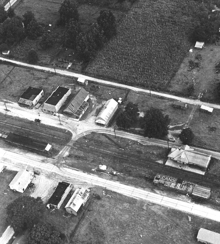
Canoe, as seen from this aerial photograph circa 1940s
Across the rugged pages of history intersect the crossroads of memory and our own personal recollections and reflections. Yet with the passing of each successive generation much history is forgotten unless close attention is paid to the oral history and grainy records stored in forgotten places and dusty attics. Such is the case with Canoe Station which blossomed like a flower in spring and whose golden age passed away like frost on a winter morning.
During Canoe's golden age, disasters and accidents were a constant threat. It would appear the town never had a fire department and this put the many wood frame buildings at great risk.
One such disaster is recorded in The Atmore Record on March 11, 1909, "Last Saturday night about 9pm, the store of Mr. H.C. Mills at Canoe, five miles above Atmore was burned to the ground. The building was all in flames, being discovered, and burned so rapidly that nothing could be saved."
The presence of the railroad running through the center of the town posed a serious risk of derailment and disaster as well.
The Greenville Advocate noted on June 16, 1922; "Last Thursday at 2pm one boy killed and one man seriously hurt and many passengers considerably frightened. A switch had been left opened or the train split the switch, when running about 40 mph, and ran into some cars being loaded with potatoes, standing on the siding. One report has it that the men were in a potato house and the train ran into the house. The train was delayed only a few hours, the engine, baggage and express cars were turned over, a pullman derailed, and one day coach was found exactly across the track.
Other than hurricanes, the most serious disaster to have befallen the town was almost certainly the fire of November 17, 1922.
The Baldwin Times documented the misfortune on November 23, 1922; "Fire was discovered at 3am on Friday November 17th in the potato dry house belonging to P.E. Stanton, and from there spread to the gin house and seed house to Dr. Watson's brick building that was being used as a drug store, and to the railroad loading platform. The cause of the fire is unknown but most of the property was uninsured."
It is somewhat ironic that much of this property was uninsured in that the Sanborn Map Company had surveyed Canoe and its buildings on February 24, 1922. Sanborn made detailed maps of urban areas of the US in the 19th and 20th centuries. The maps were used by insurance companies to access their liabilities in certain areas and thereby determine insurance rates.
When insurance companies began using a process known as "line carding," the need for detailed map making of towns and businesses fell out of favor with underwriters. Yet for researchers the maps are an invaluable resource for charting the progression of change in towns and cities. A friend had encouraged me to order one for Canoe for quite some time yet due to day to day priorities it took a while for this to happen.
Upon receiving my map from the University of Alabama, which has many of the maps on file, several fascinating discoveries about Canoe were made.
The most obvious discovery was the difference in street names on the Sanborn maps and the names we are familiar with today. The first Sanborn map for Canoe was made seven years before Highway 31 came through the town. The road was eventually incorporated into 31 but was called Railroad Street in 1922. What we call Hill Street today was called Hall Street, Baker Street was known as Carney Street and South Canoe Road was called Pensacola Street.
Neither Lowery Lane (the location of this year's Canoe Homecoming Festival) nor Canoe Road North shows a name on the map. However, Myrick Lane is referred to as Watson Street on the Sanborn map. There is also a barber's shop listed along Lowery Lane, this shop's existence is somewhat forgotten to many today.
Brick buildings are denoted by a red rectangle on the map, therefore Farrar's Store and the old Canoe Bank, which stood next to today's Confederate monument, are so noted. At the corner of today's Hill Street and Highway 31 once stood Homer Lee's Store and later Findley's Grocery. Yet in 1922 it is listed as belonging to Davison Fore (see article from two week's ago on Fore's grocery).
It is difficult to say how much effect the June train derailment and the November 1922 fire had on the local Canoe economy, or if it in any way contributed to the economic downtown that would have occurred in 1929 at the outset of the Great Depression, yet it is fascinating to have the Sanborn Map as a resource. Within a short time it should available for viewing at the Canoe Civic Center.
Shadows and Dust Volume III: Legacies is available for purchase in the amount of $30.00+$5.00 shipping and handling to PO Box 579 Atmore, AL 36502 or visit Lulu Publishing.com; Amazon.com, Barnes and Nobles.com OR at the Monroe County Heritage Museum in Monroeville, Alabama or by calling 251 294 0293.